Menu
Log in
Log in


News

Only VVCC Members can comment on News posts. Not a Member and want to comment? Please join the VVCC by clicking here

  • 29 Apr 2013 7:28 PM | Kevin Adams (Administrator)

    The VVCC is excited to release a digital trail map of the Verde Valley and the trails through out. The map is available currently within the App Store through a App called Avenza PDF Maps. The App its self is free and the map priced along side comparable paper maps @ $11.99. The map uses the GPS in your iOS or Android device to show your location on the map. Once the map is purchased there is no need for 3G, 4G or any Service period. All the map needs is good sky view. I have tested the map deep in the West Fork of Oak Creek far far away from cell service and works like a charm. You can add waypoints with notes and photos, share your location and much more. This will be a great tool for non motorized trail users to navigate and truly know where they are on the map.

    The proceeds from sales of this map goes right back to the land we love. Funds benefit the VVCC trail care fund which assists in trail development, construction and maintenance.

    A big thanks to Aaron Seifert of GISeifert for his help in building this map!!!!

    HOW DO I GET IT?


    iOS

    Click the logo above to get info on the App or search the App store on your iPhone\iPad for Avenza PDF Maps. Once the app is loaded go to the in App map store and search maps around me by list to find the VVCC Trail Map. Purchase and download which will take a few minutes and your done.

    Android

    Currently Android is in it's Beta version and does not have the Map Store built in.......Soon.

    http://www.pdf-maps.com/android/beta This link will lead you to the Beta Version to install on your Android device.

    http://www.pdf-maps.com/get-maps This link will allow you to purchase the map.


  • 24 Apr 2013 7:23 PM | Kevin Adams (Administrator)

    Check it out, right around the corner. Let's Celebrate some singletrack!!! Click the image for more info.


  • 21 Apr 2013 7:19 PM | Kevin Adams (Administrator)


    May 17th-19th

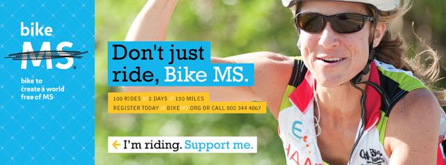
    Bike MS is the premier bike ride in Arizona and is part of the country’s largest national cycling series supported by the National Multiple Sclerosis Society. Hosted in the Verde Valley in central Arizona approximately two hours north of Phoenix, Bike MS is the largest two-day, fully catered cycling event in the state and is an annual fundraising event to support the Arizona Chapter of the National Multiple Sclerosis Society. This event offers several route options that give you the chance to challenge yourself while riding through the beautiful Red Rock Mountains or enjoy a fun ride with your family and friends through the Verde Valley. Cyclists collect pledges from thousands of volunteers both in Arizona and nationwide, who consistently raise more than $500,000 annually. While you’re out riding with us, SAG (Support and Gear) vehicles continually travel the route between rest stops, medical support is provided, as well as expert bike maintenance and repair from supporting bicycle shops.

    EVENT WEEKEND TIMELINE (**subject to change**)

    Friday, May 17th

    12:00pm Participant Camping Open

    5:00pm-8:00pm Expo Open to all

    Thinking about coming early? No problem! You can park your RV, pitch your tent, or sleep in the large circus sized tent provided by the National MS Society on Friday to get a jump start on Saturday morning. There is a secured area where you can lock your bike for security on Friday & Saturday night. If you are camping out Friday night, please bring a bike lock. 

    Saturday, May 18th, Cottonwood, AZ

    Day-of Packet Pickup/check-in will begin at 5:30am. The ride starts at 7:00 a.m. on both days. Plan on arriving early! To save time at check-in, please plan on attending one of the packet pick-ups before the ride.

    5:00am Showers available at Verde Valley Fairgrounds

    5:30–7:00am Packet pick-up

    5:30–7:30am Breakfast served at Verde Valley Fairgrounds

    6:00–7:00am Team photos

    6:30am Kick-off program

    7:00am First wave of riders start

    9:00am Lunch service begins on-route

    11:00am Lunch Starts at Verde Valley Fairgrounds 

    4:00–10:00pm Festival, Beer Garden

    12:00–8:00pm VIP Tent opens at Verde Valley Fairgrounds

    1:00-8:00pm Expo Open to all 

    5:00–7:00pm Team photos

    5:00pm Course closes

    5:00–7:30pm Dinner served at Verde Valley Fairgrounds 

    6:30pm Program & Celebration Festival at Verde Valley Fairgrounds 

    10:00pm Showers close

    After the ride on Day 1, hang out with other cyclists and celebrate each other's accomplishments in moving toward a world free of MS. The evening includes a catered dinner, live music, dancing, program, New Belgium beer and more!

    Sunday, May 19th, Cottonwood, AZ

    5:00am–4:00pm Showers available

    5:30–7:30am Breakfast

    7:00am First wave of riders depart

    10:00am Lunch starts at Verde Valley Fairgrounds 

    3:00 pm Course closes

    WHAT TO BRING (required)

    Bib number, bike number

    Photo identification

    Helmet

    WHAT TO BRING (recommended)

    Water bottles and hydration packs

    Cash or checks

    Tire patch kit, spare tubes and tire pump

    Sunglasses, lip balm and sunscreen

    Padded bike shorts and jersey

    Cycling gloves and shoes

    Medications

    Rain poncho

    Camera

    Cell phones, MP3 players, and other digital devices WILL NOT be allowed on the route due to safety reasons.

    ROUTE

    Bike MS: Ride the Vortex - Sedona Verde Valley boasts one of the most scenic and beautiful routes in the country. This ride rolls through Arizona's Verde Valley from scenic Sedona to beautiful Cottonwood. Our cyclists are sure to enjoy this unique weekend of fun, fitness, new friendships and the personal satisfaction of completing a challenging 150-mile ride to help create a world free of multiple sclerosis. On Day 1 of the ride, the route will take you through the heart of Sedona and its spectacular scenery. On Day 2, we'll venture through the rolling green hills of the Verde Valley and explore some of the finest wineries and vineyards Arizona has to offer. Click here to download the 2013 route maps (It may take a few moments to load)

    HOTELS & CAMPING

    Overnight Location: Verde Valley Fairgrounds, 350 S. 12th Street, Cottonwood, AZ 86326

    Camping

    Camping will be available on site for those who wish to pop-up a tent or rest under a large sleeping tent provided by the National MS Society.

    RV Parking/Camping 

    Those who wish to bring their RV's are welcome to do so, however there is a fee. RV campers will incur fees of $15 per day for spots with electric hook ups and $7 per day for dry camping. You may also fill up your RV's water reservoir on-site for just $5. There are also designated dumping areas that you may use as well before you leave. Email Ashley Havrilla at ashley.havrilla@nmss.org to reserve your spot, then contact the Verde Valley Fairgrounds at (928) 634-3290 to make payment arrangements.

    Hotel Partners 

    Below is the list of our current hotel partners for the 2013 Bike MS Arizona ride. All room blocks are held for the nights of May 17 and 18 (Friday & Saturday). You must say that you are with Bike MS to receive the discounted rates.

    Best Western Cottonwood:993 S. Main StCottonwood, AZ 86326928-634-5575Rate: King and Double Queen rooms available for $85.99, Deluxe rooms are available for $99.00*Mention late checkout at check in.

    Quality Inn:301 Arizona 89ACottonwood, AZ 86326928-634-4207Rate: $89.75 to $95.95 for one person or two.*Request late checkout when you make your reservation.

    The View Motel: 818 S Main StCottonwood, AZ 86326928-634-7581Rate: 1 bed, 1 person $62 plus tax. Must make reservations at least 6 weeks in advance.*Request late checkout when you make your reservation

    Motel 6 Cottonwood:1089 S State Route 260Cottonwood, AZ 86326928-634-3678No rooms reserved, but if reservation is made online two months prior to event, you will get the online discount through the hotel.*Request late checkout when you make your reservation.

    Super 8 Cottonwood:800 S Main StCottonwood, AZ 86326928-639-1888Rate: $60+ tax for one bed, $70+ tax for two beds.*Must mention late checkout at check in 

    If you have any questions regarding our hotel partners please contact blaine.king@nmss.org.

    PACKET PICKUP

    Dates, times and locations are still TBD.

  • 6 Apr 2013 7:16 PM | Kevin Adams (Administrator)

    Maps generated from the most recent RTCA meeting are added including a Excel spreadsheet with all the maps generated from the last meeting. This spreadsheet will not open in Google Drive it must be downloaded and opened in Excel.

  • 22 Mar 2013 7:07 PM | Kevin Adams (Administrator)

    Release Date: Mar 21, 2013

    Contact(s): Red Rock Ranger District, 928-282-4119

    SEDONA, Ariz. – The Red Rock Ranger District of the Coconino National Forest has implemented new rules for mountain bikers in specific areas near Sedona in order to protect land and resources.

    The new rules restrict mountain bikers from leaving official National Forest system trails and prohibit bikes from cross-country travel in several specific areas. More than 170 miles of official trails remain open to mountain biking.

    Impacts from numerous unauthorized and unplanned trails used by mountain bikers have prompted the new restrictions, as unplanned trails have accelerated erosion and resulted in damage to fragile soil, archaeological and watershed resources near Oak Creek.

    In order to mitigate the damage from these unplanned routes and properly plan for the future, mountain bikers must now remain on National Forest system trails and are prohibited from cross-country travel in the following areas:

    • Schnebly Hill;
    • Airport;
    • Carrol Canyon;
    • Schuerman Mountain;
    • Cathedral Rock.

    The new restrictions will be in place for up to two years while the district and public work together to determine long-term aspects of sustainable mountain bike use, as well as equestrian and foot cross-country travel issues and effects.

    All official Forest Service trails remain open to mountain bike use, except in a Wilderness Area. The district has added 45 miles of trails in the past three years to enhance opportunities for mountain biking, which brings the total miles of trails in and around Sedona to more than 170.

    “Mountain biking is a legitimate and growing use of the National Forest and especially around Sedona,” said District Ranger Heather Provencio. “However, we encourage a ‘stay-on-trail’ ethic for all users in all areas, and over the past several years we’ve noticed an increase in off-trail damage due to mountain biking. This is why these restrictions are focused on keeping bikes on trails in the most sensitive areas. We need this use to be environmentally sustainable.”

    The Red Rock Ranger District has been hosting a series of public meetings to plan and implement a long-term sustainable trail system and continues to conduct public meetings. The district considered a larger area for the restriction but narrowed the focus after discussion with the Verde Valley Cyclists Coalition and International Mountain Bike Association—which are helping to educate users, encourage responsible riding and monitor off-trail impacts.

    The district is following the lead of places like Moab and Fruita in the requirement to keep bikes on designated trails to protect our fragile soils and watershed. This temporary restriction will be in place as the district and public collaborate and plan a long-term, sustainable trail system.

    For more information about public meetings on the Red Rock trail planning process or how to volunteer on trail projects visit www.fs.fed.us/r3/coconino/ or call the Red Rock Ranger District at (928) 282-4119.

    Click the images below to see the official Forest Order and Overview Map of the areas restricted.


  • 21 Mar 2013 7:06 PM | Kevin Adams (Administrator)

    Come help us build out the Lower Bones Trail outside of Dead Horse State Park. This system has long needed expansion and now and every friday following is your chance to be a part of it.

    Volunteers should meet at the Lower Raptor Trailhead @ 8:30am in Dead Horse State Park off of Roadrunner Road within the park. Entrance fees will be waived for volunteers.Volunteers need to come prepared and bring with them: a helmet if available (bike helmet will work), sun glasses, work gloves, drinking water, food, sun screen, a hat, long sleeved shirt, long pants, and wear boots with ankle support.

    For more detailed information on locations and to share your interest, please call Doug Brown - (928) 202-9360

  • 20 Mar 2013 7:05 PM | Kevin Adams (Administrator)

    LADIES' BEGINNER/INTERMEDIATE RIDEWED 3 APRIL - 830 AM

    BELL ROCK TRAILHEAD (AT VOC)

    THIS WILL BE AN EASY, FUN, SOCIABLE PACE (NO DROP).  DON'T FORGET YOUR HELMET AND WATER.  SPRING IS HERE!


  • 19 Mar 2013 6:57 PM | Kevin Adams (Administrator)

    Update - FS preliminary proposed map with associated appendix. None of these are final.  All docs link to full size.


  • 18 Mar 2013 6:55 PM | Kevin Adams (Administrator)

    RED ROCK TRAILS MEETING – 6-8pm HILTION IN THE VILLAGE, MARCH 21, THURSDAY – SEE YOU THERE!

    March 21             Agenda

    ·         Introductions at tables

    ·         Overview of map process                                           

    ·         Forest Plan presentation – Jennifer Burns                            20 minutes

    ·         Map work –                                                                        60 minutes

    Small and large maps will be available to “draw on”; participants can group up or work alone.

    encourage discussions about the ideas being marked up -

    ·         Group wrap-up discussion                                           20 minutes

          Any common themes jumping out?

          Any patterns in various areas showing up?

          Any challenges with this process?

          What worked about this process?

          What needs to be improved?

    (Maps will include the area around Sedona and Big Park, all official trails and shaded relief, private land, roads and other major features. Maps of existing “social and user-created trails” will be available for reference. See-through acetate will be used with markers to “draw” concepts and ideas onto the maps.)

    Maps available for take-home.

    For all previous meeting notes, go to http://www.fs.usda.gov/detail/coconino/landmanagement/planning/?cid=stelprdb5407300 or www.VVCC.us

    For those of you who want more information about the upcoming meeting:

    Goal

    - provide multiple ways in which people can provide input about the RR trail system

    Objective

    - handout 11x17 maps of the trail system to everyone there

    - post 11x17 map on website so people can continue working/thinking after the meeting

    - have 3 various maps, with acetate overlays, at each work station table for people to mark (and code) their ideas

    - have flip charts at each work station to record the "reason" for each mark along with the identification code

    - every mark on a map must have a reason why or it will not be part of the meeting record

    - people can work in groups and talk things out, they can move between groups, or they can work independently

    Goal

    - be clear about what is being asked

    Objective

    - have a facilitator at each group work station to keep the discussion flowing and make sure the reasons are being recorded

    - identify access areas

    - identify what trails they use now

    - what user experience type they enjoy on which trails

    - any ideas about user zones

    - possible connectivity/linkage opportunities

    - other ideas/issues to express

    Goal

    - see what people think is needed for future trails system and why

    - let people express their trail ideas

    - layout the approaches for future mapping meetings

    Ground Rules, such as:

    - think about concepts before marking

    - make conceptual marks (not detailed) and record the reason for that mark

    - every mark must have a reason or it will not be recorded

    - no lobbying of or for ideas

    - be respectful of others

   
EVENTS


The VVCC is a 501(c)(3) non-profit founded in 2003 (incorporated in March 2004) to promote road and mountain bike advocacy in, and around, the Verde Valley of Northern Arizona.


CONTACT US

Email: board@vvcc.us


Powered by Wild Apricot Membership Software