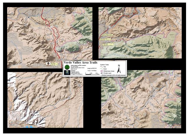
The VVCC is excited to release a digital trail map of the Verde Valley and the trails through out. The map is available currently within the App Store through a App called Avenza PDF Maps. The App its self is free and the map priced along side comparable paper maps @ $11.99. The map uses the GPS in your iOS or Android device to show your location on the map. Once the map is purchased there is no need for 3G, 4G or any Service period. All the map needs is good sky view. I have tested the map deep in the West Fork of Oak Creek far far away from cell service and works like a charm. You can add waypoints with notes and photos, share your location and much more. This will be a great tool for non motorized trail users to navigate and truly know where they are on the map.
The proceeds from sales of this map goes right back to the land we love. Funds benefit the VVCC trail care fund which assists in trail development, construction and maintenance.
A big thanks to Aaron Seifert of GISeifert for his help in building this map!!!!
HOW DO I GET IT?

iOS
Click the logo above to get info on the App or search the App store on your iPhone\iPad for Avenza PDF Maps. Once the app is loaded go to the in App map store and search maps around me by list to find the VVCC Trail Map. Purchase and download which will take a few minutes and your done.
Android
Currently Android is in it's Beta version and does not have the Map Store built in.......Soon.
http://www.pdf-maps.com/android/beta This link will lead you to the Beta Version to install on your Android device.
http://www.pdf-maps.com/get-maps This link will allow you to purchase the map.